 Open Data Science Europe Metadata Catalog
unknown
Type of resources
Available actions
Topics
Keywords
Contact for the resource
Provided by
Years
Formats
Representation types
Update frequencies
status
Resolution
-
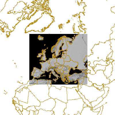
This is a cropped DTM version (with Frame2c) for providing topographic backgrouds on EEA maps. This is a hillshade of global digital elevation model (DEM) with a horizontal grid spacing of 30 arc seconds (approximately 1 kilometer).
-

CHELSA V1.2 (http://chelsa-climate.org/) is a high resolution (30 arc sec, ~1 km) climate data set for the earth land surface areas. It includes monthly and annual mean temperature and precipitation patterns for the time period 1979-2013. Methods are described in http://chelsa-climate.org/wp-admin/download-page/CHELSA_tech_specification.pdf. CHELSA Version 1.2 is licensed under a Creative Commons Attribution 4.0 International License. Specifications: High resolution (30 arcsec, ~1 km) Precipitation & Temperature Climatologies for the years 1979 – 2013 Incorporation of topoclimate (e.g. orographic rainfall & wind fields). All products of CHELSA are in a geographic coordinate system referenced to the WGS 84 horizontal datum, with the horizontal coordinates expressed in decimal degrees. The CHELSA layer extents (minimum and maximum latitude and longitude) are a result of the coordinate system inherited from the 1-arc-second GMTED2010 data which itself inherited the grid extent from the 1-arc-second SRTM data. Note that because of the pixel center referencing of the input GMTED2010 data the full extent of each CHELSA grid as defined by the outside edges of the pixels differs from an integer value of latitude or longitude by 0.000138888888 degree (or 1/2 arc-second). Users of products based on the legacy GTOPO30 product should note that the coordinate referencing of CHELSA (and GMTED2010) and GTOPO30 are not the same. In GTOPO30, the integer lines of latitude and longitude fall directly on the edges of a 30-arc-second pixel. Thus, when overlaying CHELSA with products based on GTOPO30 a slight shift of 1/2 arc-second will be observed between the edges of corresponding 30-arc-second pixels. To redistribute the data, please cite the following peer reviewed articles: <a href="https://www.nature.com/articles/sdata2017122"target=_blank>Karger, D.N., Conrad, O., Böhner, J., Kawohl, T., Kreft, H., Soria-Auza, R.W., Zimmermann, N.E., Linder, H.P. & Kessler, M. (2017) Climatologies at high resolution for the earth’s land surface areas. Scientific Data 4, 170122.</a> <a href="https://doi.org/10.5061/dryad.kd1d4"target=_blank>Karger, D.N., Conrad, O., Böhner, J., Kawohl, T., Kreft, H., Soria-Auza, R.W., Zimmermann, N.E., Linder, H.P., Kessler, M. (2017) Data from: Climatologies at high resolution for the earth’s land surface areas. Dryad Digital Repository. </a>
-

Preview of the hillshading map for EU.