 Open Data Science Europe Metadata Catalog
EVI
Type of resources
Available actions
Topics
Keywords
Contact for the resource
Provided by
Formats
Representation types
Update frequencies
status
Resolution
-
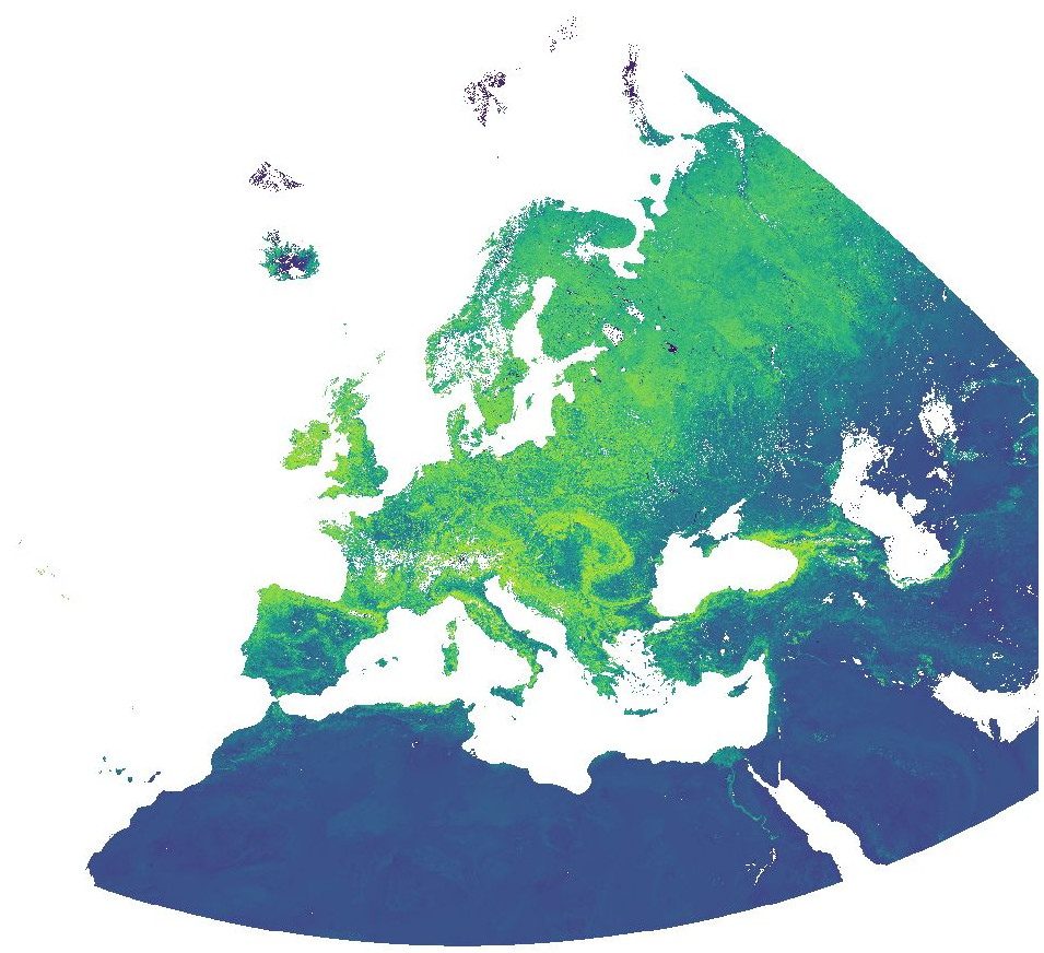
Normalized Difference Vegetation Index (NDVI) and Enhanced Vegetation Index (EVI) from MODIS data for Europe at 1 km resolution. Source data: - MODIS/Terra Vegetation Indices 16-Day L3 Global 500 m SIN Grid (MOD13A1 v006): https://lpdaac.usgs.gov/products/mod13a1v006/ - MODIS/Aqua Vegetation Indices 16-Day L3 Global 500 m SIN Grid (MYD13A1 v006): https://lpdaac.usgs.gov/products/myd13a1v006/ The MOD/MYD13A1 Version 6 product provide Vegetation Index (VI) values at a per pixel basis at 500 meter (m) spatial resolution. There are two primary vegetation layers. The first is the Normalized Difference Vegetation Index (NDVI), which is referred to as the continuity index to the existing National Oceanic and Atmospheric Administration-Advanced Very High Resolution Radiometer (NOAA-AVHRR) derived NDVI. The second vegetation layer is the Enhanced Vegetation Index (EVI), which has improved sensitivity over high biomass regions. The algorithm for this product chooses the best available pixel value from all the acquisitions from the 16 day period. The criteria used is low clouds, low view angle, and the highest NDVI/EVI value. For the time periods October 2016 - March 2017 and August 2020 - April 2021, the original data has been reprojected to ETRS89-extended / LAEA Europe and aggregated to a 1 km grid. The temporal resolution is 16 days. Bad quality pixels or pixels with snow/ice and/or cloud cover have been masked using the provided quality assurance (QA) layers and appear as "no data". File naming: productCode.acquisitionDate[A (YYYYDDD)]_mosaic_spatialResolution_frequency_VI.tif example: MOD13A1.A2020305_mosaic_1000m_16_days_NDVI.tif The date is Year and Day of Year. Values are NDVI/EVI * 10000. Example: Value 6473 = 0.6473